The Many Lands of Colorado
8/9/19 / Kevin Raines

As we begin a blog series about Colorado, we must first take note of the diversity of the state. We have mountains, plains, and valleys, of course, but we also have large metro areas and small towns, agricultural economies and service economies, and myriad other variations on the Colorado theme. The concept of “Colorado” is very different depending on where you are in Colorado.
After 20 years of working in Colorado demographics, I’m always intrigued to see how different organizations break out the state into regions for their work. There are some strong patterns the regional analyses I’ve seen over the years, but there are always variations. What is the overall pattern, though? If we had to come up with a consensus set of ten regions, what would they be? I decided to try to find out.
I found regional breakouts of Colorado that have been produced by a dozen large organizations or programs around the state. Those organizations divided the state into anywhere from 4 to 13 regions [1], all on a county-level basis.
The first thing I did was look for counties (or groups of counties) that were always clustered together, and there were a lot of them, mostly in the southern part of the state and in the northeast. All in all, there were ten unanimously acknowledged clusters of counties where all twelve of the maps assigned those counties to the same region. These encompassed about half of Colorado counties.
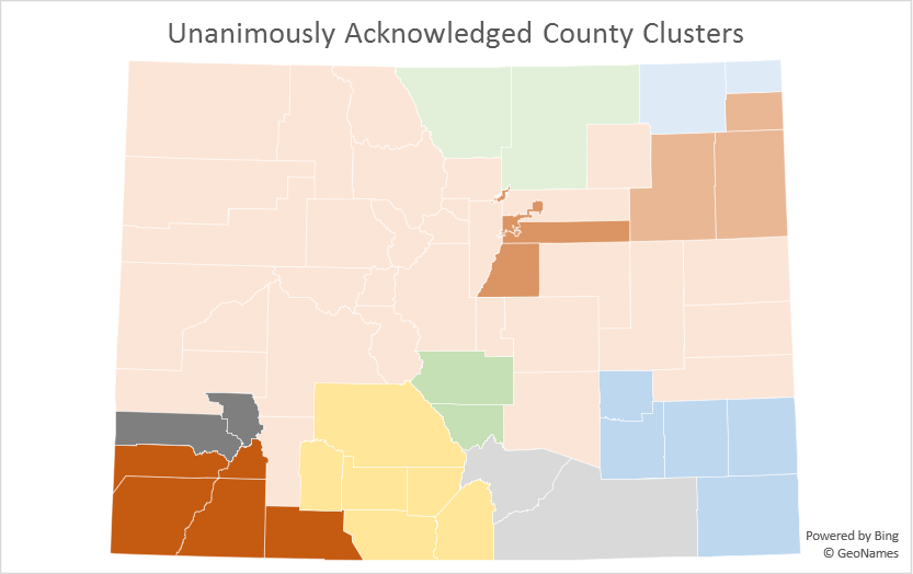
I then examined the remaining counties, and nearly all of them were strongly matched with at least one other county. In fact, only Elbert, Boulder, and Pueblo Counties were not consistently paired with a specific county in at least 10 of the 12 maps. Elbert County was split between inclusion in the major metro counties to its west and the lightly populated eastern plains counties to its east. Boulder and Pueblo Counties were generally split between anchoring their own regions and being part of a larger region.
I then took the remaining unassigned counties and grouped them based into counties where 10 or 11 of the maps were consistent. (And I took a “most common fit” for the three individualist counties.) This produced the following map.
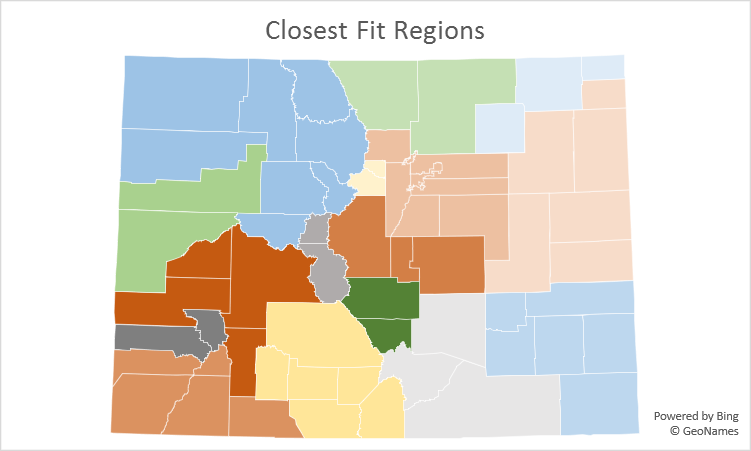
This map shows the state being divided into 16 regions of varying sizes. One can think of this as a “minimizing disagreement” map, as it best represents the choices that went into the diverse set of maps we studied.
Sixteen regions is a bit busy, so I wondered how these clusters would collapse into ten regions. In examining the extent to which the clusters have been matched against each other in the maps that I examined, I came up with the following group of ten regions.
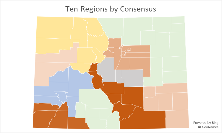
Our technique of “clustering the clusters” could be improved upon – most notably, Larimer County has little connection to the eastern plains except a shared relationship with Weld County, and Routt County tends to create connections between northwest Colorado and the mountain resort counties that are not otherwise similar. But in most instances, the exercise lets us see how regions in Colorado are commonly defined.
[1] * – The organizations were the Colorado Departments of Agriculture, Education, Economic Development & International Trade, Human Services, Local Affairs, Public Health & Environment (three different programs), and Transportation, the Colorado State Patrol, the Colorado Division of Homeland Security, and the Colorado Nonprofit Association. Maps didn’t necessarily represent an overall organizational view, and usually represented a particular program that had a regional focus.